-
 Home
Home
-
 About Us

-
 Service Application

-
 Latest News
-
 Statistics
-
 Geographical Knowledge

-
 Geographic Information Application

-
 Introduction
-
 Geospatial Portal
-
 Macao Online Map
-
 Macao 3D Map
-
 Cadastral Information Website
-
 Macau GeoGuide
-
 GeoGuide for emergency
-
 Traffic Geographic Information Website
-
 Macao Satellite Positioning Reference Station Service (MoSRef) Website
-
 Macao Street and Door Number Enquiry System
-
 Walking Routes Map
-
 Applications Programming Interface for Geographic Information
-
-
 Tender

-
 Opinions
-
 Contact Us
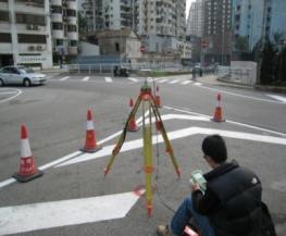
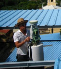
The establishment of MoSRef has driven the popularization of Macao's satellite positioning technology. While performing "coordinate measurement", "on-site lofting", and "topographic surveying", the Macao Cartography and Cadastre Bureau will employ the satellite positioning measurement technology. Relevant technologies have raised the efficiency of work and the precision of results. Specifically, the applications of the specific satellite positioning technology in mapping in Macao can be classified into the following categories:
1. Cadastral and topographic surveyingStatic and real-time kinematic satellite positioning technologies are combined with the traditional measurement technology to determine the position of boundary points, mapping control points, and surface feature points.
2. Geographic data collectionFor the collection of feature attribute data, the real-time kinematic satellite positioning method can be used to effectively acquire position data and import them into the geographic information database to provide the information required by government departments and industries for business planning.
3. Engineering measurement
Due to the continuous promotion and education of applications of the satellite positioning technology, relevant technologies have been widely applied to multiple engineering measurement tasks, including engineering setting out, deformation monitoring, and result inspection.
|
|
|
|
Cartography and Cadastre Bureau
Friday 9:00-13:00 and 14:30-17:30
[Usage Disclaimer] [Privacy Statement] [Sitemap]
Copyright©Cartography and Cadastre Bureau


