Topographic Map:
|
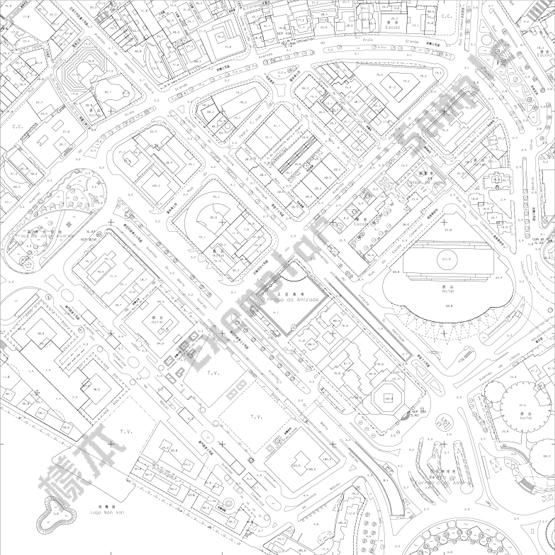
Topographic Map records the basic condition of the land features in Macao SAR, which includes buildings, streets, bridges, water, green land and other basic elements of the feature. Our bureau surveys the land feature and landform regularly to produce different scales of topographic maps for the public to purchase. The public may purchase the large scale of regional topographic map which the scales are 1:1000 and 1:2000. They can also purchase the small scale of general Macao topographic map and administrative region topographic map which the scales are 1:5000, 1:10000 and 1:25000. The topographic map will be renewed monthly for regular update and accuracy. |
Digitized Map:
|
As the development of GIS and electronic geographic data, our bureau also provides the public the digitized map of Macao SAR with scales of 1:1000, 1:10000 and 1:20000 (the data formats are DWG and DGN) as well as SHP format map of scales of 1:1000 and 1:5000. All of three DVD contain very plentiful and detailed land feature information. The public may check the description list of each DVD before they purchase the items. The digitized map will be renewed monthly.
|
Thematic Map:
|
Thematic maps emphasize on showing one or various types of natural elements or social-economic phenomena. The contents are composed of thematic data and general geographic information, and are also attached with related information such as text description, statistics etc. on the map. Our bureau now provides the following three types of thematic map:
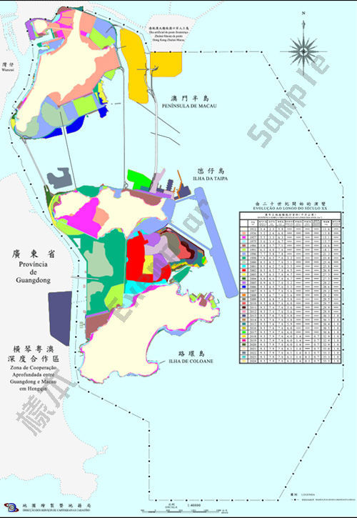
The evolution from the beginning of the 20th century: This thematic map mainly depicts the general condition of reclamation and land developments in Macao from the beginning of the 20th Century. Because of land shortage, the size of Macao increased from 11.6 square kilometers at 1912 to 30.4 square kilometers at 2015 through land reclamation. The map shows the land reclamation condition in different time through different color blocks, helping the public to understand the land development condition of Macao region.
Green Area Map of the Macao SAR: The public can understand the distribution of green areas in the Macao SAR through this thematic map, in which the dark green spot denotes natural mountains while light green artificial oases.
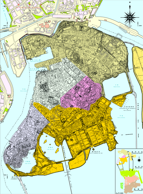
Parishes Map of the Macao SAR: The public can understand the Parishes distribution of the Macao SAR through this thematic map. The distribution is mainly related to the government statistics, zonal election and establishment of health centers. |
Aerial Photography:
|
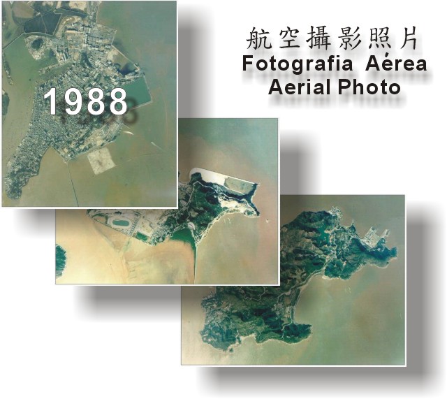
Aerial photograph is made from photography system installed in airplane or other aircraft. It takes picture of scenery and things on the surface of the earth. The carrier of aerial photograph is generally airplane or low-altitude aircraft, of which the elevation is much lower than the satellite, therefore the capacity of spatial resolution is generally higher than the satellite, and the sharpness of the land substance is comparatively high. The aerial photographs our bureau providing are of the year 1941, 1980, 1988, 1993 and 1998. There are more precise large zonal aerial photographs in those of the year 1980, 1988 and 1993. The public may purchase order after zone choosing. |
Map of the Macao SAR and the Adjacent Regions:
|
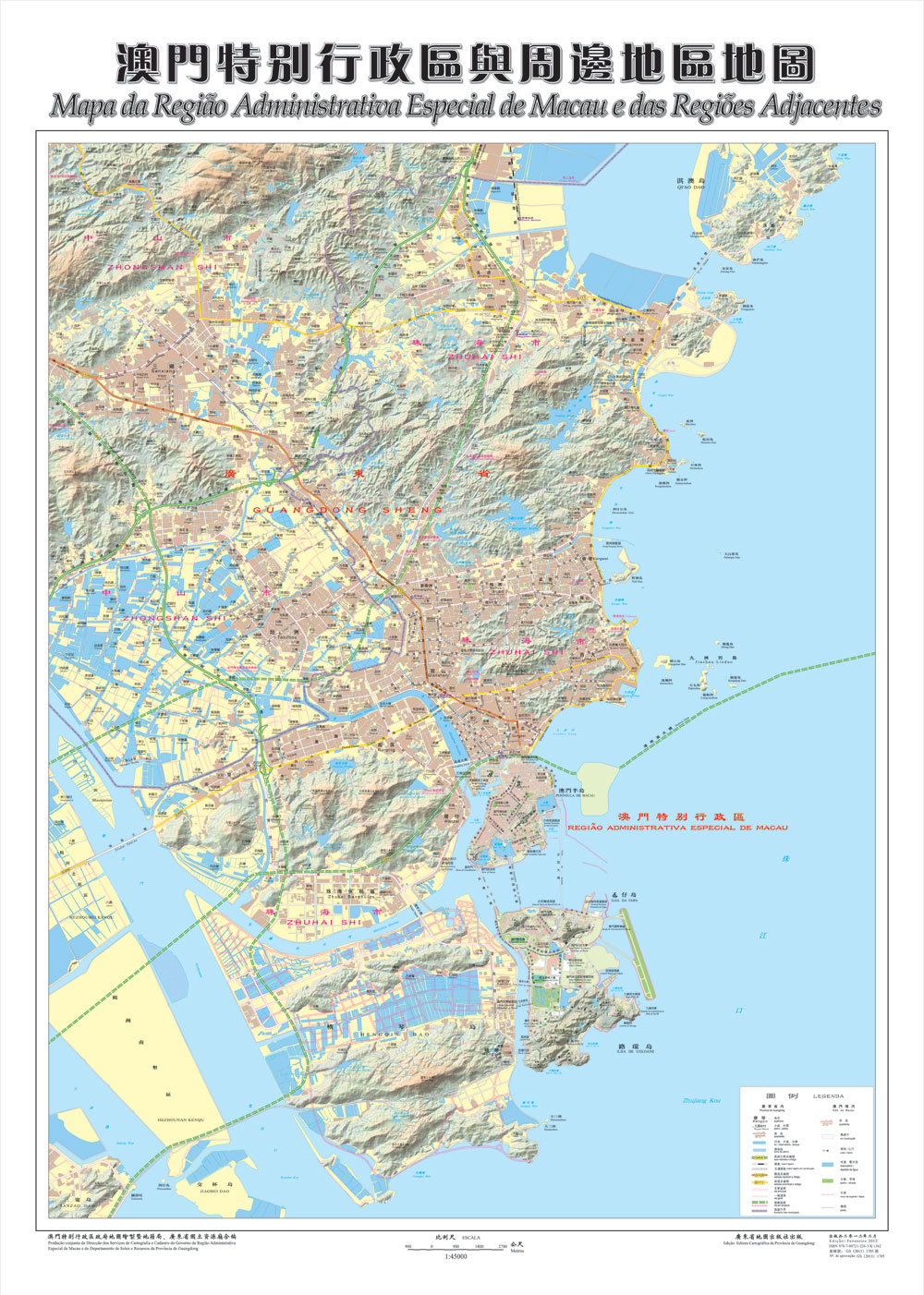
Map of the Macao SAR and the Adjacent Regions As Guangdong and Macao have become more and more related, and economic, tourism and trading intercourse are gradually increasing, the public also demands more geographical information of Macao and the adjacent regions. Therefore it is very necessary to produce a map that indicates the present geographical distribution of the Macao SAR and the adjacent regions. In June 24 of 2003, the Department of Soils and Resources of Guangdong Province and the DSCC of the Macao SAR Government signed an Agreement of Scientific Co-operation. According to its spirit, both parties worked together cooperatively to produce "Map of the Macao SAR and the Adjacent Regions", which covers the Macao SAR, Zhuhai, Zhongshan, Hengqin, Qiao, Jiuzhou Islands, etc. with a scale of 1:45000, it mainly reveals the distribution of town areas, waters, roads and landform. The public can understand the geographical situation and the city development condition of the Macao SAR and the adjacent regions in Guangdong Province through the map. |
Atlas:
|
Atlas is a book composed of several maps, mainly recording the current geographic situation of a particular region. Cartography and Cadastre Bureau currently offers the following 2 atlases:
- "Atlas of Macao"
"Atlas of Macao" is edited and published by Cartography and Cadastre Bureau. It presents various features of Macao natural environment, urban situation, geographic situation and tourism resources, as well as several kinds of thematic map recording different period of Macao geographic situation. The 4 versions of Atlas, published in 2005, 2011, 2019 and 2024 respectively, are now for sale.
- "Atlas of Zhuhai•Macau"
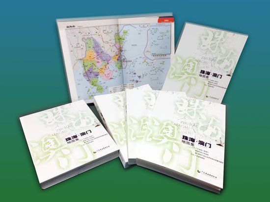
The "Atlas of Zhuhai•Macau" is a joint compilation by Cartography and Cadastre Bureau of the Government of the Macao SAR, Department of Land & Resources of Guangdong Province and Land & Resources Bureau of Zhuhai City. “Atlas of Zhuhai•Macau” is the first Atlas with compilation of geographical information of the two regions, it enhances information exploration, utilization and sharing. It is mainly presented by orthophoto aerial maps, accompanied by detailed street maps for the central and main development zones of the city so that users can get more acquainted with the geographical conditions in Zhuhai and Macao.
|