|
|
|
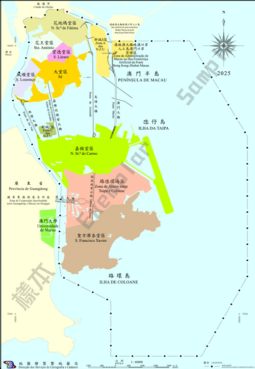
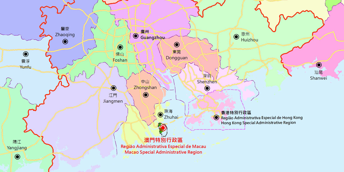
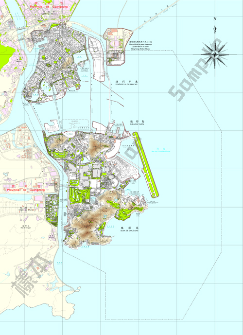
| Macao Special Administrative Region is situated on the southeast coast of China and the west shore of the Pearl River Delta. It is adjacent to Guangdong Province and is about 60 km away from Hong Kong Special Administrative Region. Macao Special Administrative Region is composed of Macao Peninsula, Taipa Island and Coloane Island | |
| In accordance with the Chief Executive Notice No. 128/2015 on 20 Dec. 2015 which orders the publication of the Decree No. 665 of the State Council of the People's Republic of China, the Map of Administrative Division of the Macao Special Administrative Region, which was approved by the 116th Executive Meeting of the State Council held on 16 Dec. 2015, comes into force. According to the new Map, the administrative division boundaries are adjusted, and the land and maritime areas under the jurisdiction of Macao SAR are demarcated. The terrestrial part consists of the Macao Border Inspection Building Section at the Border Gate and the Canal Dos Patos Section, while the maritime part consists of the Inner Harbor Section, the Taipa-Coloane Canal Section, the Waters South of Macao Section, the Waters East of Macao Section, the Artificial Island Section and the Waters North of Macao Section. From west to east, Macao covers an area from 113°31’41.4” E to 113°37’48.5” E, and from south to north, 22°04’36.0” N to 22°13’01.3” N. Meanwhile, the Central People's Government has decided that the sea area of Macao SAR should be clearly defined as 85 square kilometers. The total area of Macao has been expanding due to coastal reclamation. As at December 2025, the total land area of Macao SAR had expanded to 33.4 square kilometers. | |
|
|
|
Macao SAR is comprised of seven parishes:
Source: Municipal Affairs Bureau
|
|
-
 Home
Home
-
 About Us

-
 Service Application

-
 Latest News
-
 Statistics
-
 Geographical Knowledge

-
 Geographic Information Application

-
 Introduction
-
 Geospatial Portal
-
 Macao Online Map
-
 Macao 3D Map
-
 Cadastral Information Website
-
 Macau GeoGuide
-
 GeoGuide for emergency
-
 Traffic Geographic Information Website
-
 Macao Satellite Positioning Reference Station Service (MoSRef) Website
-
 Macao Street and Door Number Enquiry System
-
 Walking Routes Map
-
 Applications Programming Interface for Geographic Information
-
-
 Tender

-
 Opinions
-
 Contact Us
Cartography and Cadastre Bureau
Office hours: Monday to Thursday 9:00-13:00 and 14:30-17:45
Friday 9:00-13:00 and 14:30-17:30
Friday 9:00-13:00 and 14:30-17:30
Address: Estrada de D. Maria II, 32-36, Edificio CEM, 5th floor, Macao
QR code:


Last Updated:
[Usage Disclaimer] [Privacy Statement] [Sitemap]
Copyright©Cartography and Cadastre Bureau


