-
 Home
Home
-
 About Us

-
 Service Application

-
 Latest News
-
 Statistics
-
 Geographical Knowledge

-
 Geographic Information Application

-
 Introduction
-
 Geospatial Portal
-
 Macao Online Map
-
 Macao 3D Map
-
 Cadastral Information Website
-
 Macau GeoGuide
-
 GeoGuide for emergency
-
 Traffic Geographic Information Website
-
 Macao Satellite Positioning Reference Station Service (MoSRef) Website
-
 Macao Street and Door Number Enquiry System
-
 Walking Routes Map
-
 Applications Programming Interface for Geographic Information
-
-
 Tender

-
 Opinions
-
 Contact Us
Introduction to Coastline Survey and Revision
Time base
The reference date for the first Coastline Survey of Macao SAR is July 1, 2017, and the reference date for the Coastline revision of Macao SAR is January 1, 2023.
Introduction
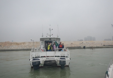
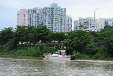
Photos on coastline survey and revision
The reference date for the first Coastline Survey of Macao SAR is July 1, 2017, and the reference date for the Coastline revision of Macao SAR is January 1, 2023.
Introduction
Coastline Survey in 2017 is conducted based on the principles of respecting history, management status quo and considering future development. The Cartography and Cadastral Bureau commissioned the professional research institutions in the mainland, the South China Sea Planning and Environment Research Institute of the State Oceanic Administration, and cooperated with various administrative authorities of Macao SAR, including: Macao Customs, Marine and Water Bureau, Land and Urban Construction Bureau (formerly the Land, Public Works and Transport Bureau), DSOP (formerly the Infrastructure Development Office), Environmental Protection Bureau, Civil Aviation Authority, Transportation Infrastructure Office (revoked), Municipal Affairs Bureau (formerly the Macao Civic and Municipal Affairs Bureau), Legal Affairs Bureau, Public Security Police Force, Economic and Technological Development Bureau (formerly the Economic Bureau) and Transport Bureau, in collecting the preliminary data and investigating the current status and future planning of the coastal areas in Macao SAR through preliminary data collection. Through field investigations on the sea and land, the departments conducted an in-depth analysis of the actual utilization and administration status of the coastal areas of Macao SAR, with a focus on the assessment and analysis of the particularities of coastal utilization and administration. In reference to relevant surveying standards in the mainland and the actual situation in Macao SAR, the departments formulated the coastline definition criteria in line with the actual situation in Macao SAR, and adopted the measurement techniques including precision satellite positioning, underwater radar survey and UAV survey. Finally, they completed the coastline survey on the Macao Peninsula, Taipa Island, Cotai Reclaimed Area, Coloane Island, and the Macao Port Administration Area on the Zhuhai-Macao Artificial Island of the Hong Kong-Zhuhai-Macao Bridge, and comprehensively investigated the topographical elements along the coast of Macao SAR, and collected geographical data such as the coastline location, length and types, thus establishing and updating the geographic information on the coastlines of Macao SAR in a standardized manner.
The coastline survey conducted an in-depth investigation and research on the current status of the coastal terrain in the Macao SAR. The acquired geographic data of the coastline will provide key geographic information for the Macao SAR government in the administration of the water and land areas. Meanwhile, the project also established the technical specifications for future coastline amendment and survey. The Macao SAR Government can update the geographical information of the Macao SAR coastline in a timely manner in response to the development status of Macao SAR.
Since the completion of the first coastline survey, the Cartography and Cadastral Bureau has carried out topographic surveys and on-site investigations to record and collect information on changes and construction projects of the coastline, with the aim of facilitating the updating of geographic information on the coastline by carrying out topographic surveys and using new equipment for producing three-dimensional carto-topographic data as auxiliary technical method.
Photos on coastline survey and revision
|
Marine Survey |
Satellite Survey |
|
Underwater Radar Survey |
UAV Survey |
Cartography and Cadastre Bureau
Office hours: Monday to Thursday 9:00-13:00 and 14:30-17:45
Friday 9:00-13:00 and 14:30-17:30
Friday 9:00-13:00 and 14:30-17:30
Address: Estrada de D. Maria II, 32-36, Edificio CEM, 5th floor, Macao
QR code:


Last Updated:
[Usage Disclaimer] [Privacy Statement] [Sitemap]
Copyright©Cartography and Cadastre Bureau


